Avi Kwa Ame: A River Crossing
by Will Joseph
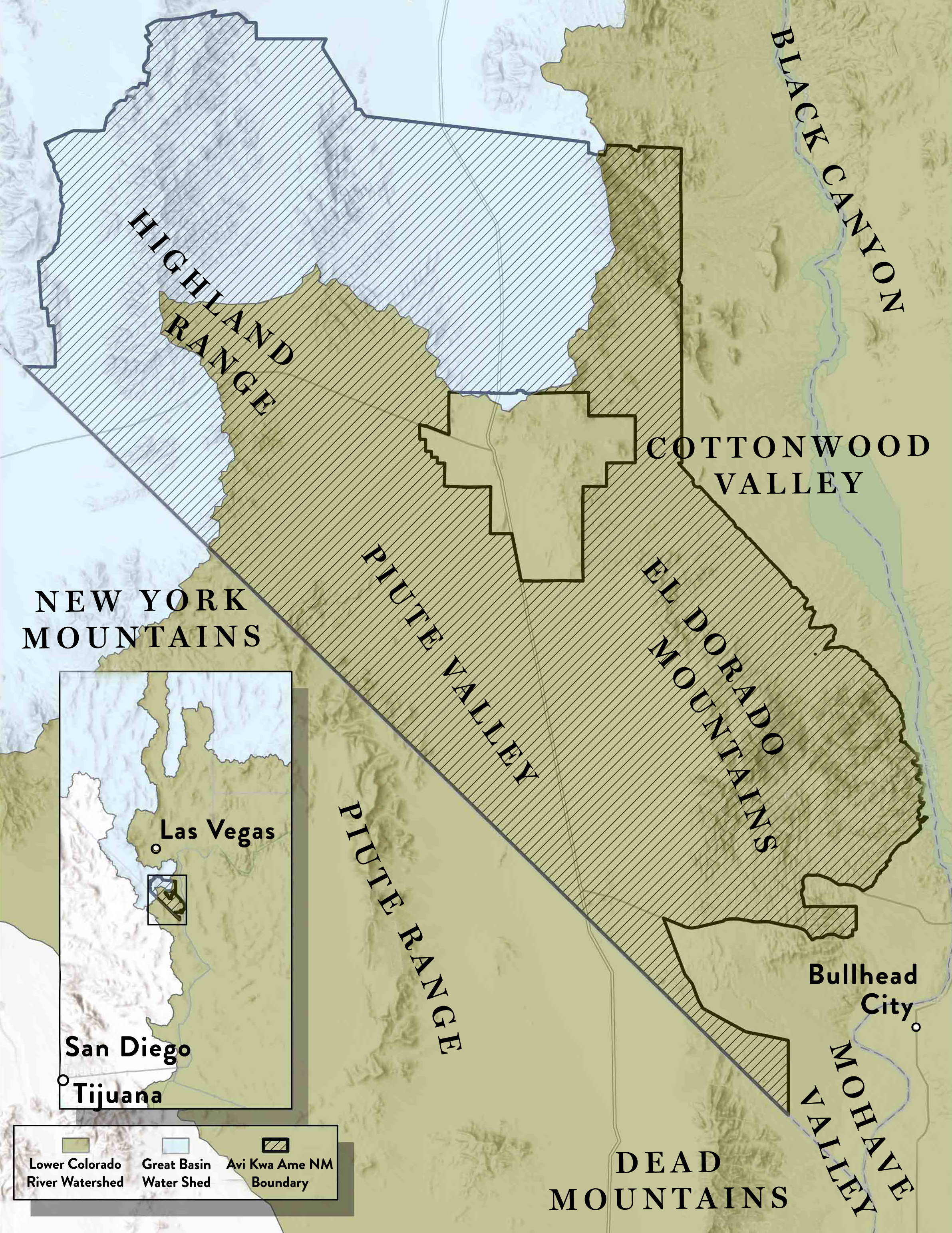
WHEN A DROP OF WATER FALLS WITHIN THE BOUNDS of Avi Kwa Ame National Monument, it begins a journey that will ultimately transport it to one of a number of vastly different destinations. A summer monsoon that falls in the Highland Range, in the northwestern section of the monument, will bring much needed moisture to the flora and fauna of the high Mojave desert. However, the course of this precipitation will flow into distinct basins depending on where it falls. South of the Highland Range, precipitation flows southward into the Colorado River and ultimately to the Pacific Ocean via the Sea of Cortez. Rain falling on the northern slopes of the Highland Range empties into the landlocked Great Basin. The reason for this has to do with geologic forces that have shaped the landscape for eons. Avi Kwa Ame lies at the crossroads of these geologic forces and represents an area that connects the Pacific to the Intermountain West.
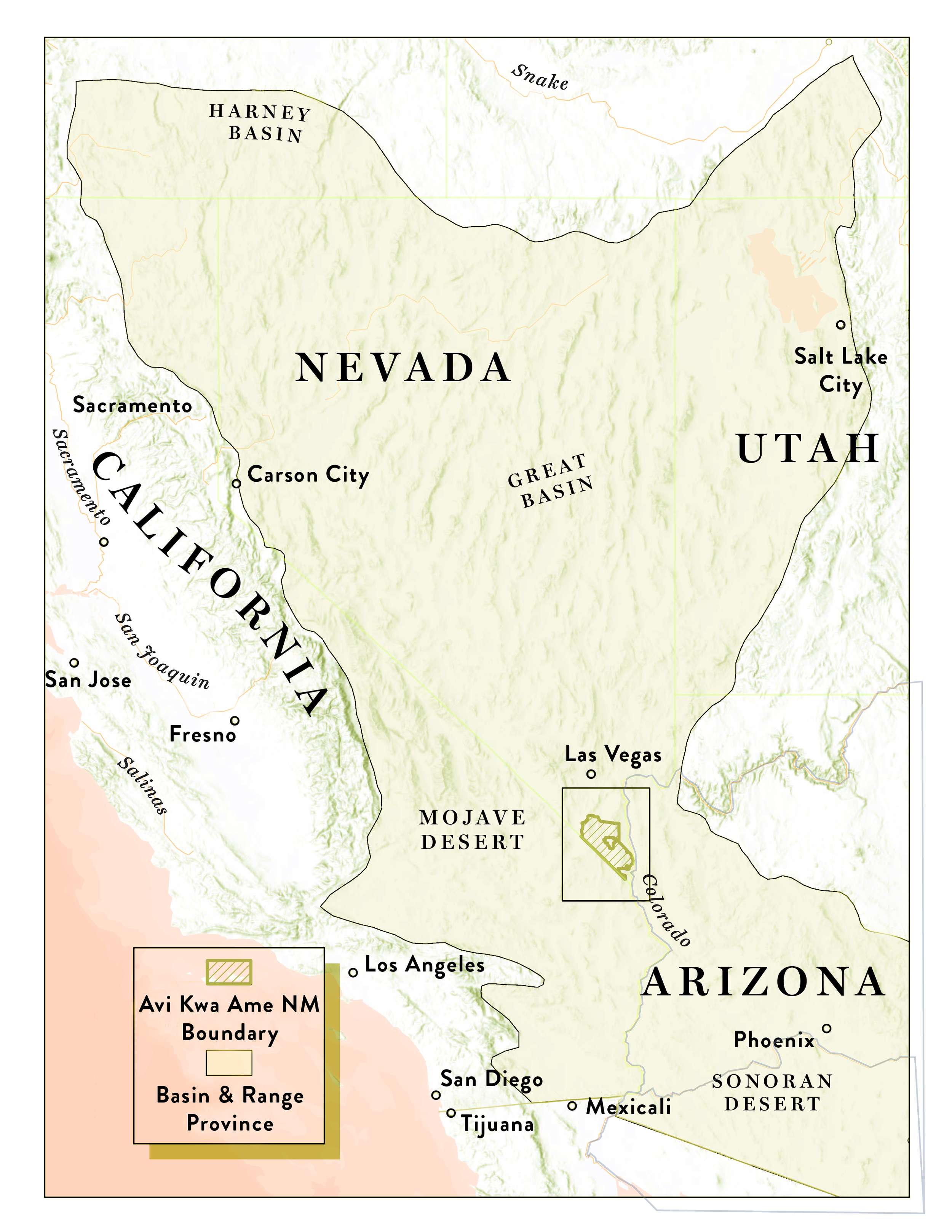
The geologic forces that created the landscapes and watersheds we observe at Avi Kwa Ame National Monument today commenced around 23 million years ago. During this time, the Earth’s crust thinned and pulled apart along faults. These faults spread mountains apart and simultaneously created adjoining basins between these ranges. Geologists refer to the area impacted by these faults as the Basin and Range province. The Basin and Range is characterized by northeast-southwest trending mountain ranges with alternating arid valleys. The province includes large portions of Nevada, Utah, California, and Arizona and extends south into Mexico.
This naming convention is not to be confused with the Great Basin, which refers to the watershed that overlaps a large portion of the Basin and Range. A watershed is an area of land that drains all precipitation (rain, snow) into a common source (lakes, streams, oceans). The Great Basin is unique in that precipitation drains into lakes, sinks, streams, and into groundwater aquifers without an outlet to the ocean. This contrasts with the Lower Colorado River basin which drains Arizona and portions of California and Nevada into the Pacific Ocean.
Avi Kwa Ame represents a snapshot into the diversity of the Basin and Range, exemplified by the overlap of these two watersheds. Biomes common to both environments can be found here in the monument. For example, juniper tree forests found in abundance in the Great Basin can be found dotting the upper elevations of the Highland and McCullough mountains. Conversely, creosote bush scrub found in the Piute Valley dominates the landscapes of the Mojave and Sonoran deserts of the Lower Colorado. The monument also provides a high-altitude haven for one of the most prolific populations of Joshua trees found in the Southwest.
Avi Kwa Ame lies at a crossroads within the greater American West. While the landscapes encountered here are unique in their transections and local adaptations, traits com- mon to both the Great Basin and Lower Colorado have been shaped by geologic forces 23 million years in the making.