DRIVE:
McCULLOUGH SPRING BACKCOUNTRY DRIVE
Road Type: One lane backcountry road.
Total Length: The McCullough Spring Backcountry Drive is 15.3 miles each way or 30.6 miles round trip.
Road Surface: Gravel with some rocky sections. This is an unmaintained road.
Vehicle Type: A 4-wheel drive, high clearance vehicle is recommended.
Difficulty: Moderate
KMZ/KML file (for use with Google Earth or similar) here
Georeferenced pdf map here
Photos by Alan O’Neill.
OVERVIEW
This backcountry drive, accessed off Nevada Highway 164 (Joshua Tree Highway), provides a diverse experience as you traverse some of the best habitat in the entire Mojave Desert, including the opportunity to see a natural spring environment. The drive starts in a Joshua tree forest which is home to some of the oldest and largest Joshua trees on the planet, including Nevada’s largest Joshua tree. The drive first parallels the eastern and northern boundary of the Wee Thump Joshua Tree Wilderness Area before it heads south towards the volcanic Highland Range and then west to the foothills of the South McCullough Mountains. It is so fascinating to see how the habitats gradually change. The geology is particularly noteworthy on the second part of the drive as there are a multitude of different formations, shapes, and colors. Also, the vegetative mix is fascinating, as there are entire slopes filled with very tall Mojave yuccas and an unusually large number of barrel cacti. There are also grasslands filledwith flowering shrubs such as spiny senna.
KNOW BEFORE YOU GO:
Should you decide to travel this route, you do so at your own risk. Always take the appropriate precautions when planning and traveling, including checking the current local weather, trail/road conditions, and land/road closures. Carry the appropriate safety, recovery, and navigational equipment and obey all public and private land use restrictions and BLM Monument rules. Carry a full-size spare tire and tire patch/plug kit—and know how to use it before you need to. Be prepared for spotty cell phone service or even no service. Bring more water and food than you think you’ll need in case of any emergencies. Please review the full route description below and download/print the directions and map before heading out.
DIRECTIONS:
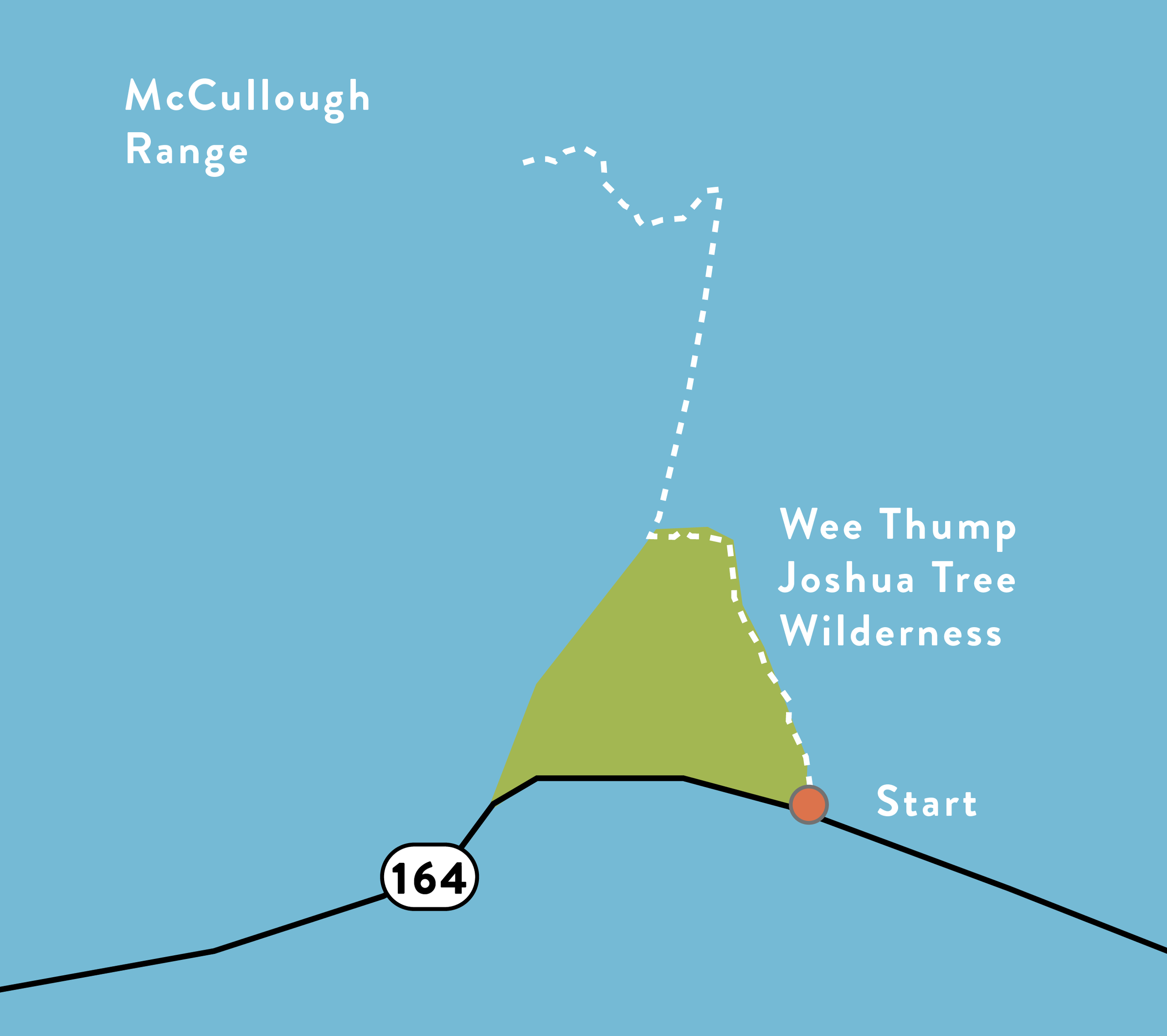
From Las Vegas, take I-515/U.S. 95 South towards Searchlight. Turn west at Searchlight on Nevada Highway #164 and go about 8 miles west of Searchlight and (about a mile past the turnoff for the Walking Box Ranch Road). Look for the backcountry road that takes off to the north along the eastern boundary of the Wee Thump Wilderness Area. Turn right on this road. Coordinates for the official start of this drive are 35.506821, -115.056400.
Alternatively, you can access McCullough Springs from the North (Henderson/Boulder City/Las Vegas valley) using the same route as our Eldorado Valley Backcountry Drive here and then making a right off of Powerline road at coordinates 35.642283, -115.079455. Taking this route, you will be able to view the transition from the lower Mojave Desert creosote/bursage vegetative community up to the higher elevation Joshua Tree/black brush vegetative community.
The drive starts at the junction of Nevada Highway #164 and the East Wee Thump Road, 8 miles west of Searchlight. The road in this section is the eastern boundary of the Wee Thump Joshua Tree Wilderness Area.
At the 4.3-mile mark, the road takes a sharp left-hand turn. Do not take the backcountry road to the right. Now you are following the north boundary of the Wee Thump Joshua Tree Wilderness Area.
At mile-mark 5.6, there is a transmission line maintenance road. Take a right on the transmission line maintenance road (on google maps as Powerline Rd., coordinates 35.566329, -115.097634).
At mile-mark 11, there is a junction with another backcountry road. Take a left on that road.
At the 1.43-mile mark, the road splits. Do not go straight. Take the road to the right.
ABOUT THE ROUTE:
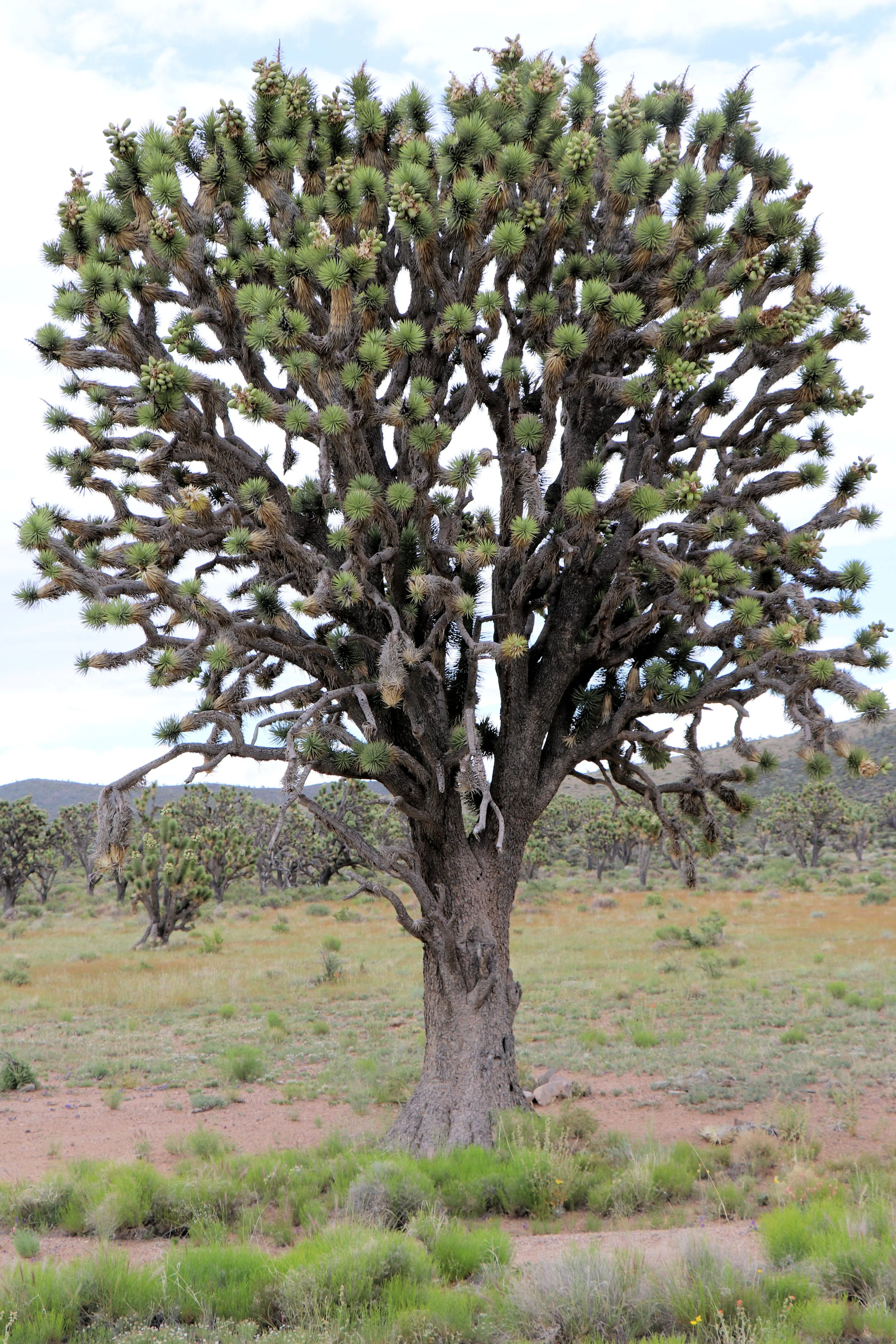
The drive starts at the junction of Nevada Highway #164 and the East Wee Thump Road, 8 miles west of Searchlight. The road in this section is the eastern boundary of the Wee Thump Joshua Tree Wilderness Area. This wilderness area is relatively small for a designated wilderness, at just 6,050 acres. But what it may lack in size, it more than makes up for in stunning natural history. Growing just half an inch per year on average, the stand is home to some of the oldest and largest Joshua trees on the planet. These ancient ones have grown tall in the silence of the desert, some rising to 30 feet over 900 years. Joshua in the Southern Paiute language, “Wee Thump” means “ancient ones”, a fitting name for this magical wilderness where the Joshua trees stand so tall and are so old.
At mile-mark 3.7, there is a backcountry road that takes off to the right and an old dry reservoir that was used when the area was grazed, prior to the early 1990s. Park here and to the left (north), there is a large Joshua Tree that stands alone. This is Nevada’s largest known Joshua Tree and perhaps the largest one on the planet. The other two were measured in California in the Mojave National Preserve and are believed to have been burnt in the Dome fire in 2019. The Nevada Division of Forestry maintains Nevada’s tallest tree program and officially measured the tree in 2022. Measurements include three factors- the height, crown width and circumference 3 feet off the ground.
At the 4.3-mile mark, the road takes a sharp left-hand turn. Do not take the backcountry road to the right. Now you are following the north boundary of the Wee Thump Joshua Tree Wilderness Area. What is amazing along this stretch is the extensive “blackbrush vegetative community.” They form these monoculture carpets of dormant summer gray. These stands are crucial parts of the desert biome. Blackbrush is hard for people to hike through, and it’s just as hard for non-human hikers to penetrate. This means that other plants’ seeds such as Joshua trees, Mojave yucca, and cacti find a congenial place to germinate and grow for a few years, out of the reach of rodent paws and rabbit jaws. Blackbrush thus acts as a “nurse plant” to many other desert species.
The area through which this part of the drive traverses has also been designated by National Audubon and Bird Life International as an “Important Bird Area,” a national designation recognizing its importance for bird conservation. Birdwatchers may spot-Gilded Flicker (known to occur in Nevada only in this location), Northern Flicker, Ladder-backed Woodpecker, Black-throated Sparrow, Red-tailed Hawk, Crissal Thrasher, Verdins, Brewer’s Sparrows, American Kestrel. Golden Eagle, Common Raven, Loggerhead Shrike, Bewick’s Wren, Bushtits, Ash-throated Flycatchers, and Cactus Wren. The Bendire’s Thrasher and LeConte’s Thrasher are also found in the Wee Thump area.
At mile-mark 5.6, there is a transmission line maintenance road. Take a right on the transmission line maintenance road (on google maps as Powerline Rd., coordinates 35.566329, -115.097634). As you lose elevation, you leave the Joshua trees behind and this section is dominated by large Mojave Yucca, blackbrush, staghorn cholla and creosote.
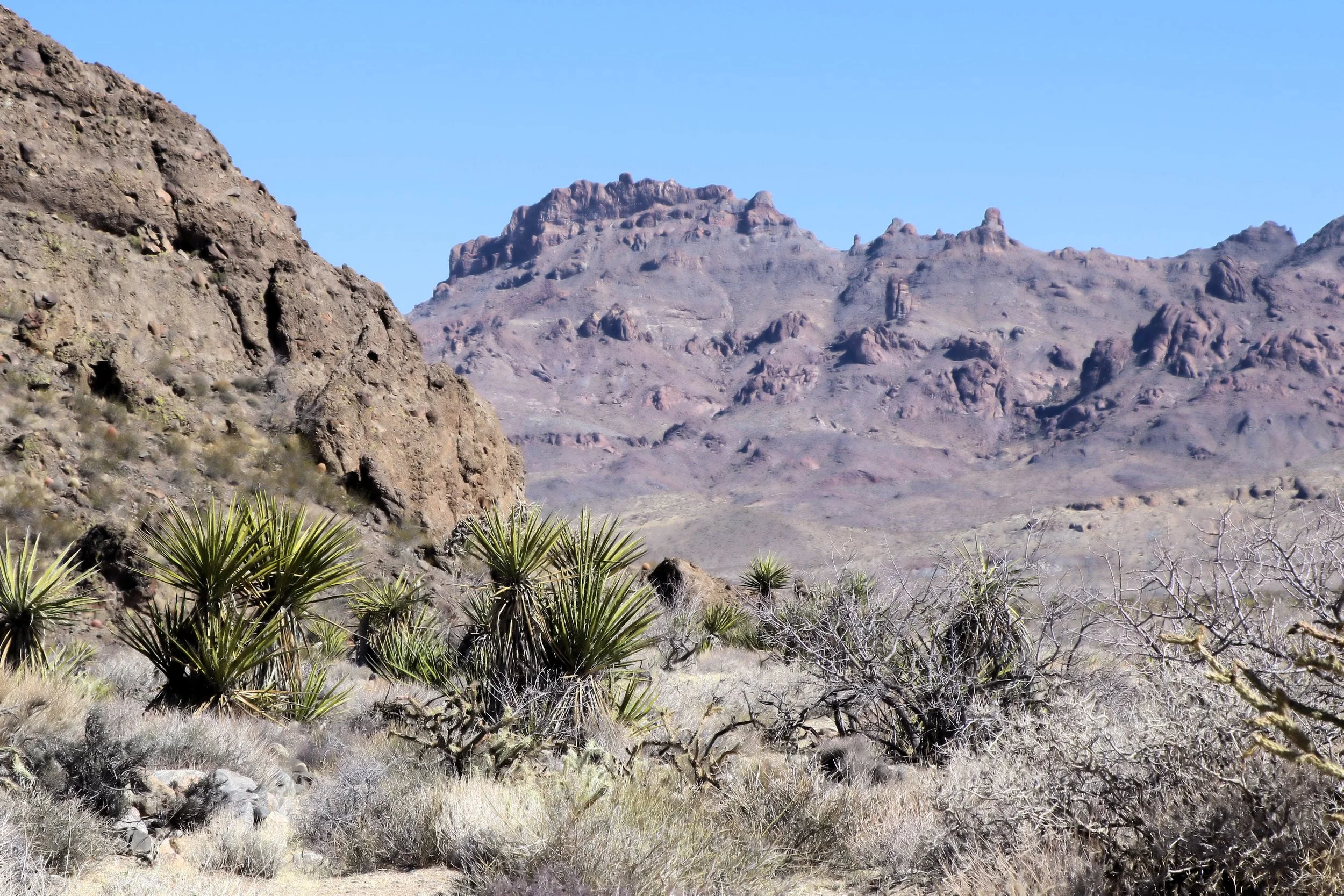
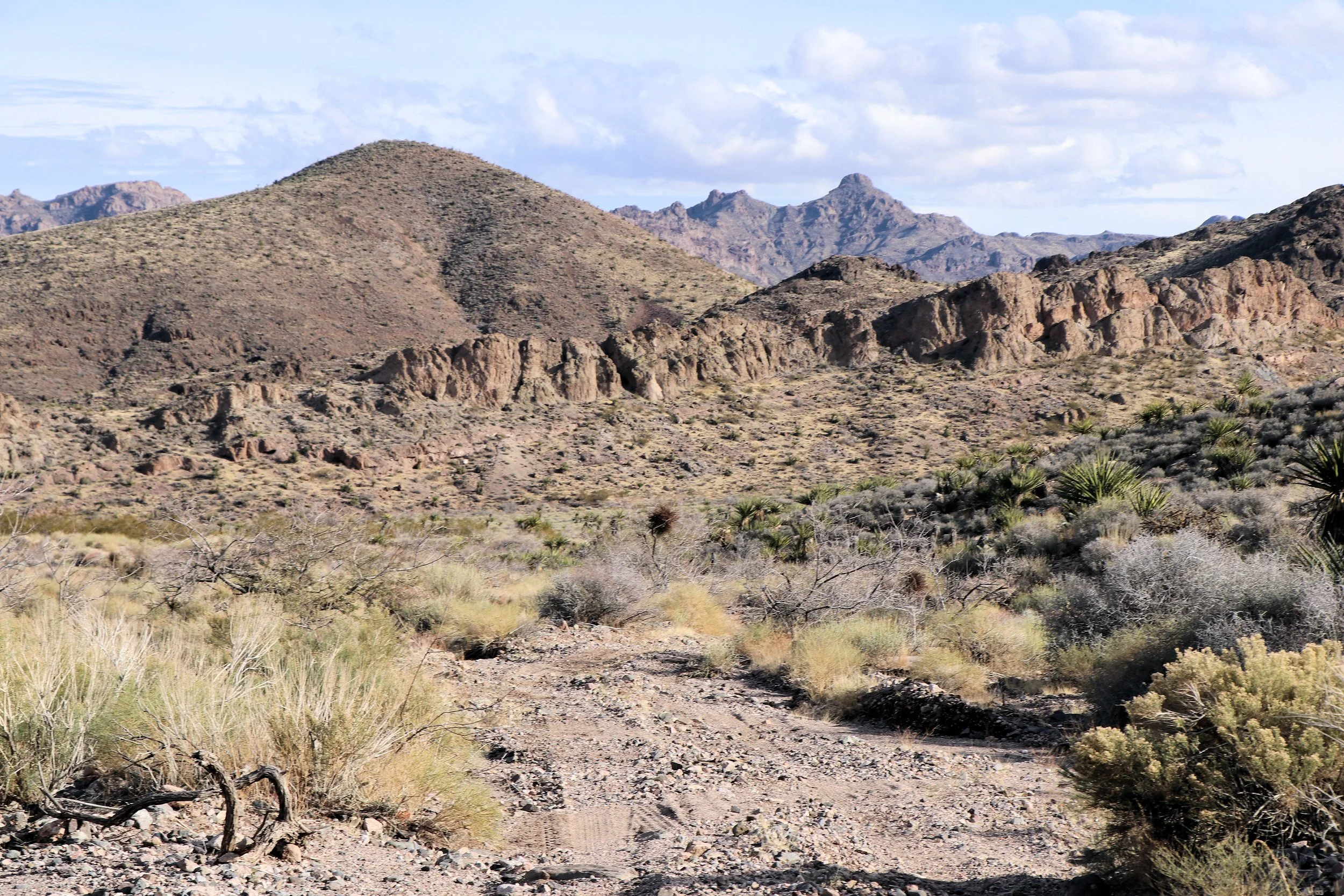
You get commanding views of the Highland Range looking east. The volcanic Highland Range is about 10 miles long and remarkably rugged and ragged. The peaks of the Highland Range tower several thousand feet above the surrounding valley and are remarkably scenic. The Highland Range provides a vital home to a small remnant herd of desert bighorn sheep that survived when many other sheep populations in Nevada were lost to drought, human encroachment, disease, and other environmental pressures. The view looking east along the drive is the Highland Range.

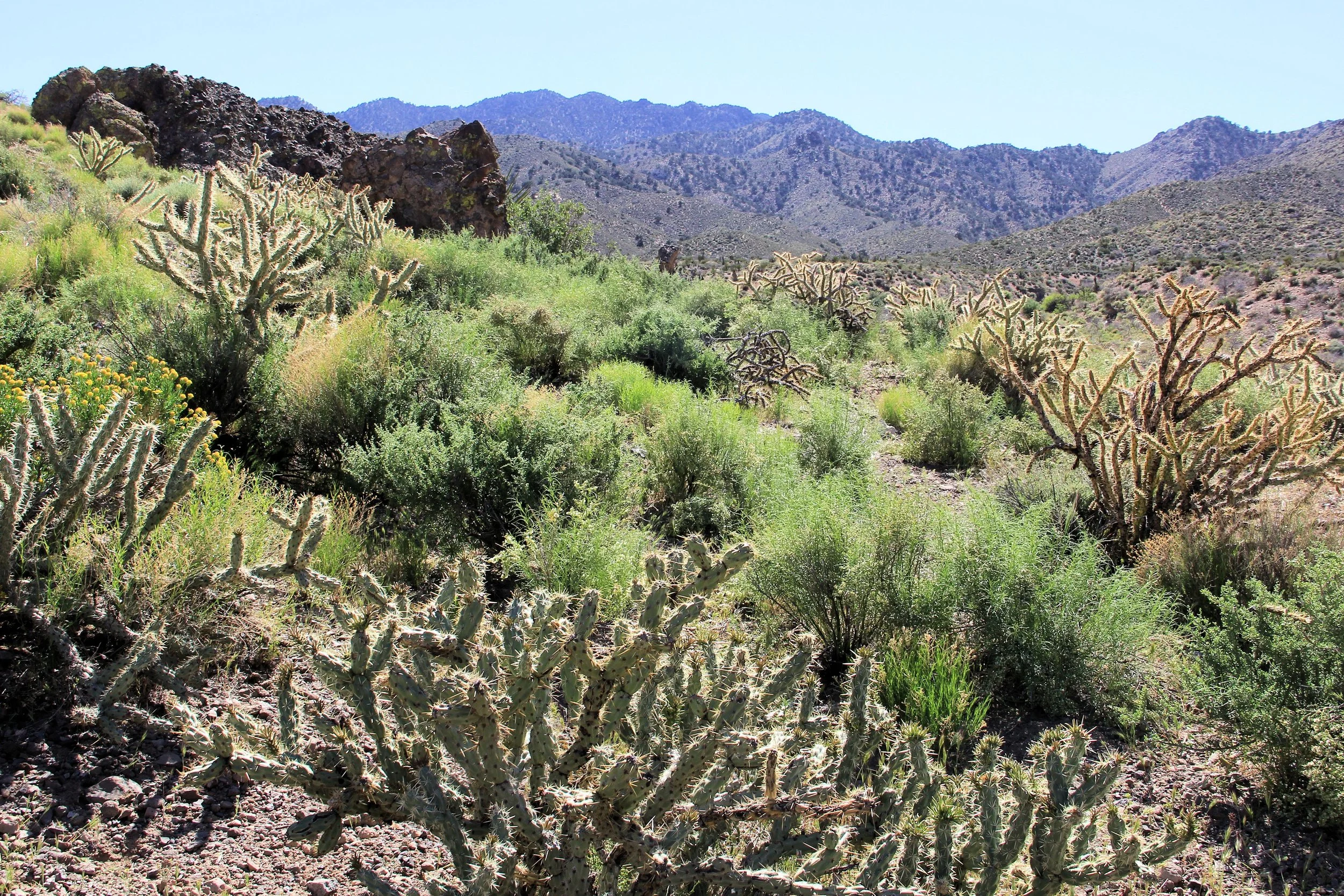
At mile-mark 11, there is a junction with another backcountry road. Take a left on that road. This section of the drive is on a sandy, gravelly one-lane backcountry road and traversing a Mojave Desert Scrub vegetative community where creosote, Mojave yucca, Banana Yucca, Buckhorn Cholla, and low-growing shrubs are common. Scattered Honey Mesquite occur in washes, as do more common Catclaw Acacia and Apache Plume. This part of the drive goes through critical desert tortoise habitat. You get outstanding views of the Highland Range to the east.
The view looking west is of the South McCullough Mountain Range which provides a distinctively different backdrop. They rise to over 7,000’ with forested slopes and are an uplifted fault block range of gneiss and granite.
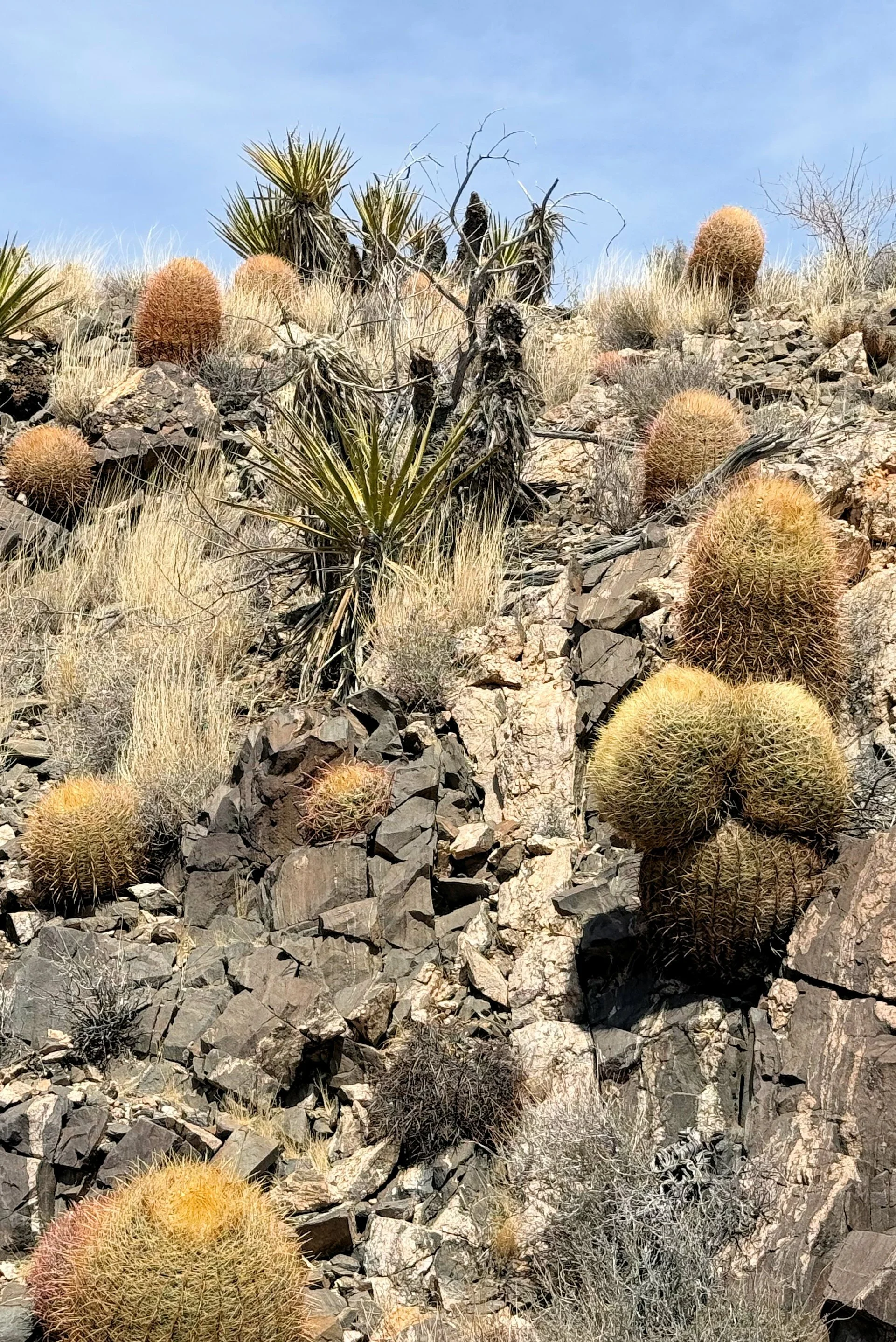
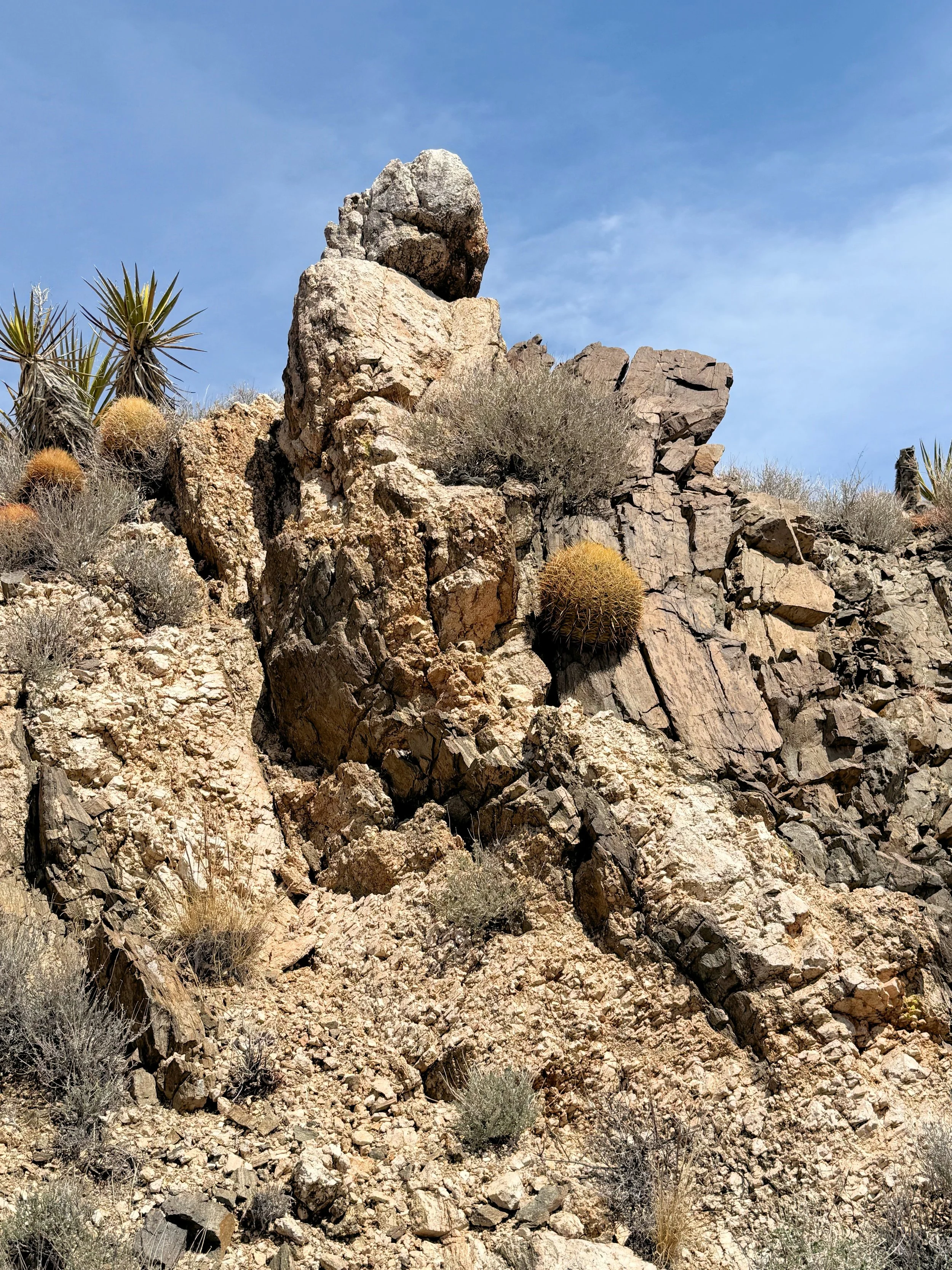
At the 1.43-mile mark, the road splits. Do not go straight. Take the road to the right. Along this stretch, the road becomes rockier and the geology more fascinating with multi-colored cliffs and rugged volcanic formations. As you get closer to McCullough Springs at a little higher elevation, you get more blackbrush and larger yuccas, barrel cacti, prickly pear cacti, hedgehog cactus, some scattered Joshua Trees, and some scattered juniper trees. There is an unusually large number of barrel cacti in this section of the drive and some of the yuccas are over 10 feet tall.
There are also plentiful desert almonds which are a spiny, woody shrub about 6’ tall. Desert Almond is a relative of our commercial almond that is smaller than the store-bought almonds that you are familiar with, but they have the same familiar structure: a furry outer covering, a thinner inner shell, and a nut inside. Its leaves have tiny hair on its surface to reduce water loss. Native Americans pounded the almonds into flour and leached the plant material to make it edible. This leaching was necessary, as the almonds contain a small amount of cyanide, a toxic chemical. Nuts can also be roasted to remove any cyanide. Small amounts can be safely eaten without any processing. Desert Almond’sfruits start to develop in April, and they are generally ready for harvest in June and July. Antelope Ground Squirrels are attracted to the plant’s nuts and harvest them in large quantities. The Desert Almond is an important nectar source for butterflies, bees and wasps.
At mile mark 2.4, you enter a more grasslands type of vegetative community with plentiful Spiny Senna. Desert Senna is one of those surprising plants that almost disappear into the landscape until it bursts into bloom in the spring with an explosion of brilliant yellow flowers that can cover almost every inch of the plant. Most of the year, Desert Senna is a tight collection of erect green and gray stems that add vertical texture to the landscape but fool many people into thinking it is dead. Its small leaflets in two to four pairs drop off soon after emerging, leaving its spine-tipped branches naked most of the year. Because the leaves of this plant are few, the plant actually uses the green stems to carry out the process of photosynthesis.
At the 3-mile mark, the hillsides are covered with large Mojave yucca and an unusually large number of barrel cacti. There are impressive geologic ridges and foothills leading to the main uplift of the South McCullough Mountains.
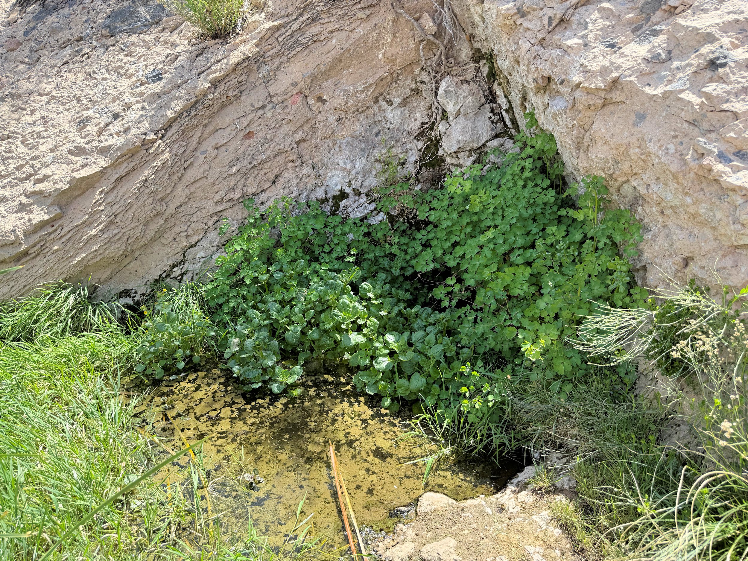
At mile 4.2 is McCullough Spring and some remnants of a historic grazing corral complex. Here you are at the base of the South McCullough Mountains and at the boundary of the 43,996-acre South McCullough Wilderness Area, created by the U.S. Congress in 2002. The wilderness area is part of the Avi Kwa Ame National Monument. Even visiting the edge of the wilderness area provides a great introduction to this wonderful and wild place.
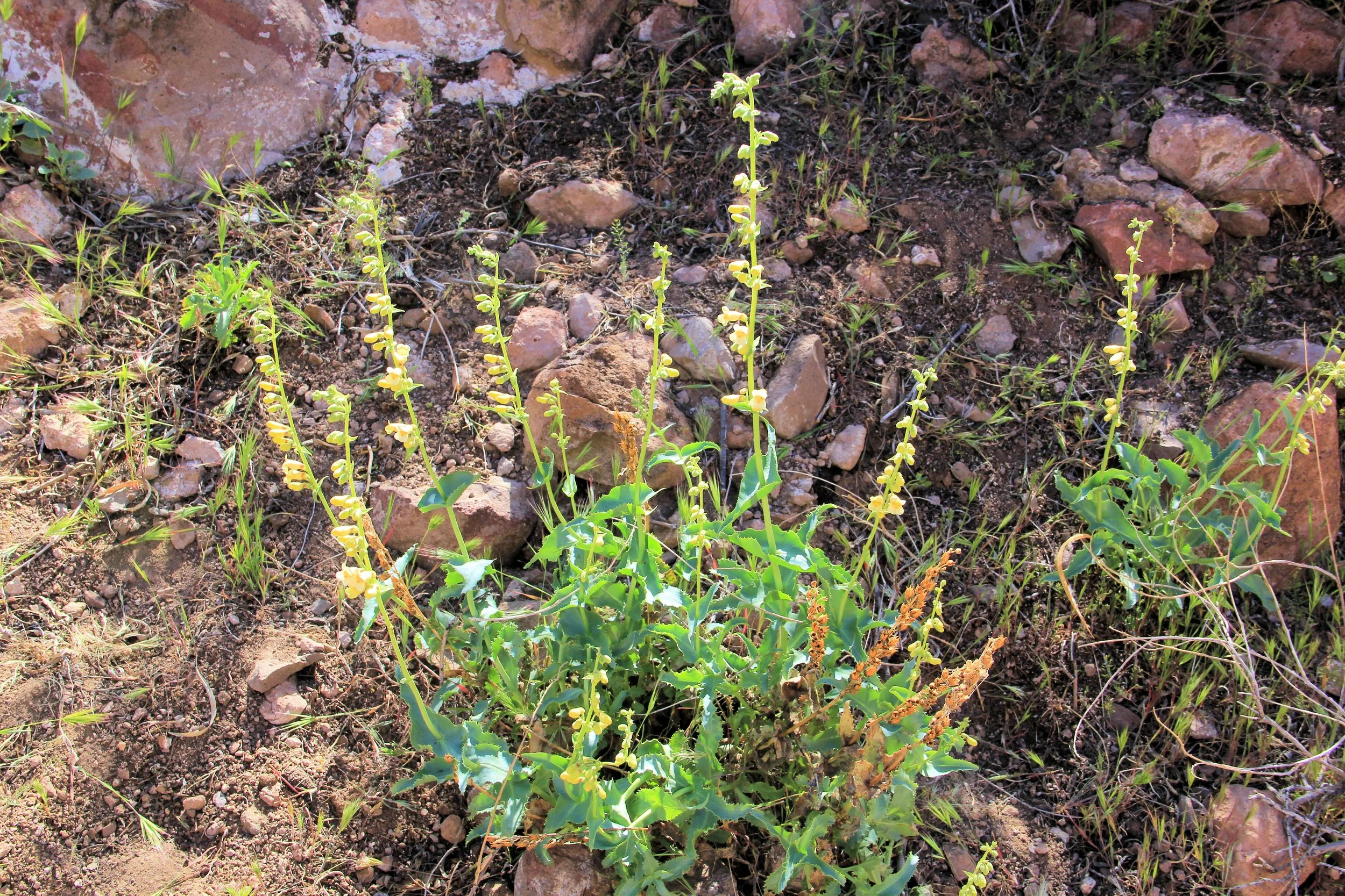
McCullough Spring is an important water source for the Desert Bighorn Sheep and other wildlife. It also habitat for yellow two-toned penstemon which is a BLM designated special status species. The year-round spring flows right out of the base of a cliff into a small pool, spilling over the side and eventually disappearing beneath the sandy wash several feet beyond. The area adjacent to the spring has some desert willows and mesquite trees.