DRIVE:
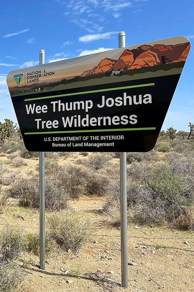
WEE THUMP BACKCOUNTRY LOOP

Type: One-lane backcountry road loop
Total Trail Length: 15.5 miles
Trail Surfaces: 11.5 miles unpaved gravel road, 5 miles paved
Vehicle Type: High clearance vehicle needed, 4-wheel drive not required
Difficulty: Easy to moderate
OVERVIEW
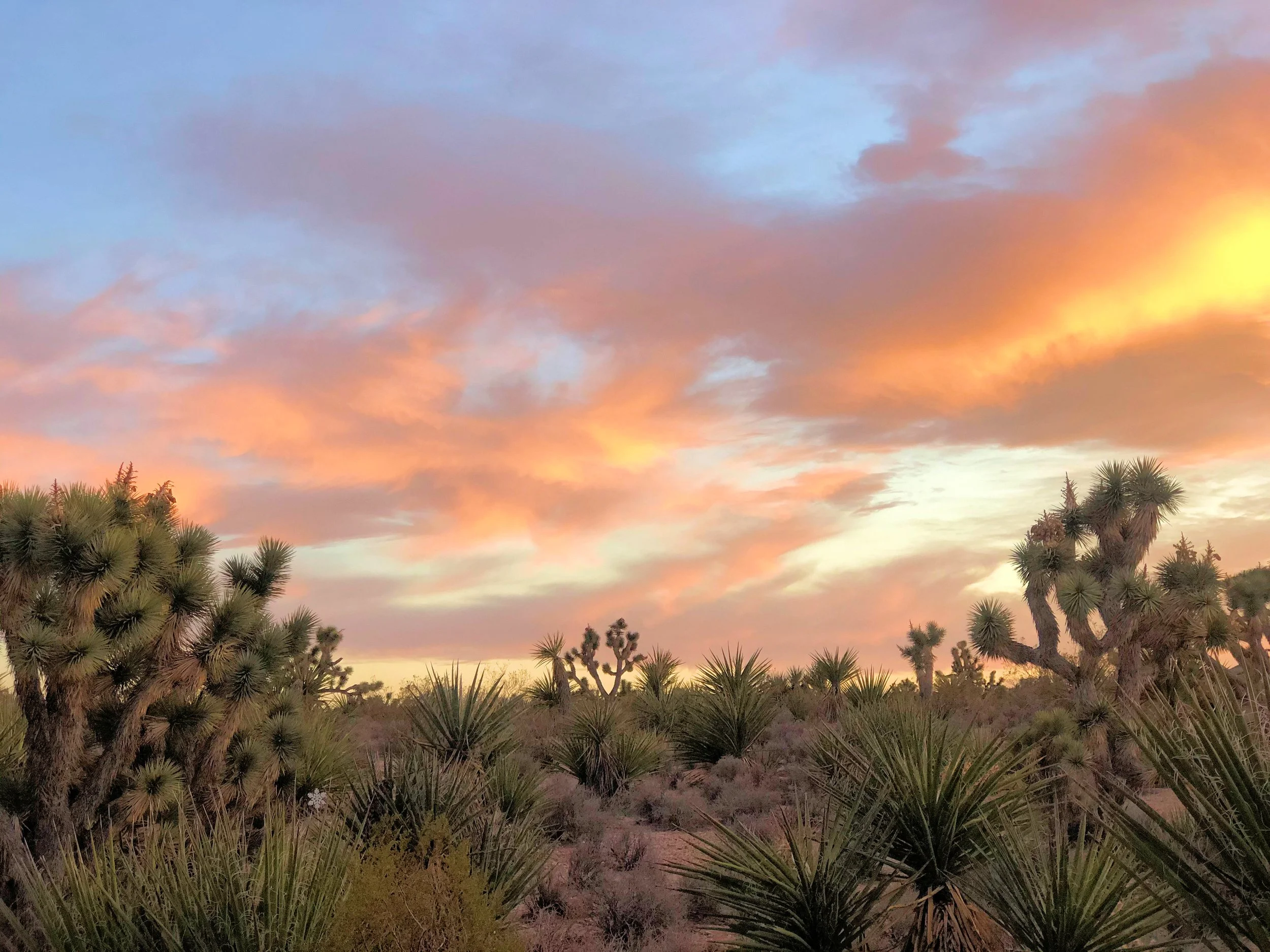
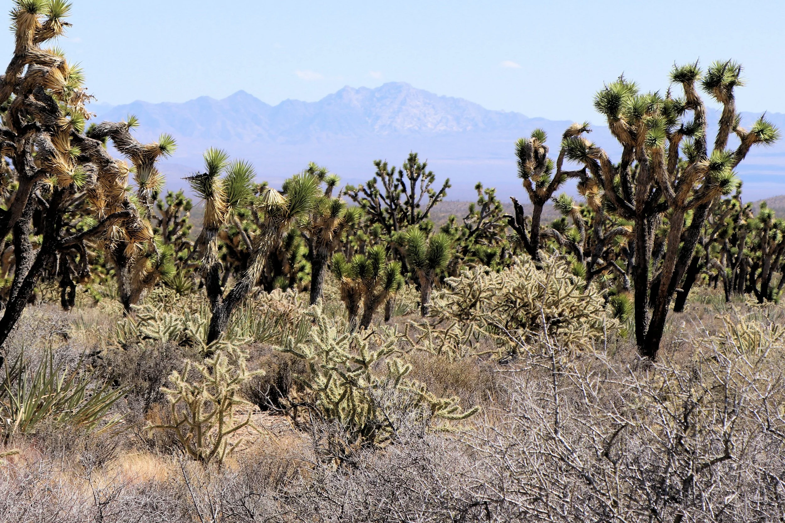
One of the most fascinating locations to visit within Avi Kwa Ame National Monument is the Wee Thump Joshua Tree Wilderness Area. If you are not a hiker or backpacker, a wonderful alternative way to enjoy this area is to take the backcountry loop drive that follows the designated boundary, allowing you to make a 15.5-mile loop. The dirt road follows the east, north and south boundary of the Wee Thump Wilderness Area boundary, and connects back to Nevada Highway #164. Along the drive, you will be struck by the lush and dense desert vegetation and rich biodiversity. This is the eastern extension of the world’s largest Joshua Tree Forest. The drive also offers views of the South McCullough and New York Mountain ranges as well as distant views of Avi Kwa Ame (Spirit Mountain).
DIRECTIONS & ACCESS:
The Wee Thump Loop Drive starts off Nevada Highway #164 (Nipton Road) about 8 miles west of Searchlight and 1.5 miles past the turnoff for Walking Box Ranch Road (there is a BLM sign set off the highway, but no roadsign).
Turn north off of the highway onto this dirt road and set your trip odometer to track your mileage.
At 4.3 miles in, you’ll come to a fork in the road and make a sharp left turn (the road to the right does not loop back).
At mile-mark 5.6, turn left on the transmission line maintenance road that heads southwest.
At the 9.7-mile mark, there is a junction of another backcountry road. Leave the transmission line maintenance road and turn left on this road.
At the 10.5-mile mark, you will reach Nevada Highway #164 and be back on a paved road. Turn left and it is five-miles back to where you started.
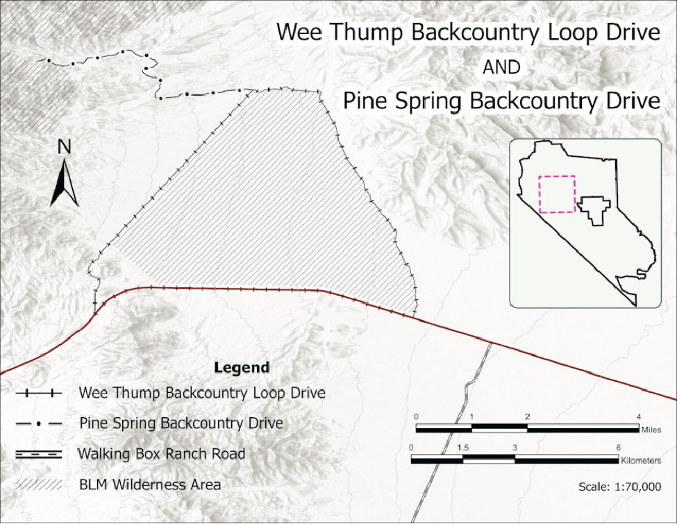


ABOUT THE ROUTE:
The drive starts at the junction of Nevada Highway #164 and the East Wee Thump Road, 8 miles west of Searchlight. The road in this section is the eastern boundary of the Wee Thump Joshua Tree Wilderness Area. This is relatively small for a designated wilderness, at just 6,050 acres. But what it may lack in size, it more than makes up for in stunning natural history. Growing just half an inch per year on average, this is home to some of the oldest and largest Joshua trees on the planet. These ancient ones have grown tall in the silence of the desert, some rising to more than 30 feet over 900 years. Joshua Trees currently are only found growing in the United States Southwest (California, Nevada, Utah and Arizona).
The Joshua tree’s fibrous root system can spread nearly 40 feet, enabling it to thrive in its harsh, dry environment. This plant is not a true tree, but a member of the Agave family (Yucca brevifolia). Until recently, it was considered a giant member of the Lily family. However, modern DNA studies led to the division of that formerly huge family into 40 distinct plant families. Because of these studies, Joshua trees now have the more accurate Agave family designation.
The name “Joshua tree” is attributed to Mormons passing west through the Mojave Desert from Utah in the mid-19th century in search of a new promised land. It is said that the Mormons named the tree Joshua, after the Old Testament figure who led the children of Israel in the conquest of Canaan. It seemed to them the outstretched limbs were directing the Mormons forward into another promised land. In the Southern Paiute language, “Wee Thump” means “ancient ones”, a fitting name for this magical wilderness where the Joshua trees stand so tall and are so old.
The Joshua relies on an astonishing symbiotic relationship with the tiny Joshua tree moth to perpetuate its existence – which in turn, sustains the moth’s survival. Joshua trees don’t produce nectar to attract pollinators. Its survival is dependent entirely on the tiny yucca moth. Built to navigate around the tough waxy foliage, yucca moths collect pollen from one part of the flower and drop it off on the female part, moving from bloom to bloom. The yucca moth’s survival is also dependent on the Joshua tree, which provides the perfect place to lay eggs within the ovary which will develop into a seed pod. The seeds are the yucca moth caterpillars’ only source of food. It’s through this most unique partnership that both survive in this unlikely place.
For thousands of years Native American groups have embraced the Joshua tree as a valued cultural and practical resource. They traditionally ate Joshua tree buds and flowers, as well as developing seeds in the pods. They also used the roots for basketry material to create a dark, reddish-brown design in the finished basket. (Please do not gather any part of these protected plants.)
At mile-mark 3.7, there is a backcountry road that takes off to the right and an old dry reservoir that was used when the area was grazed, prior to the early 1990s. Park here before continuing on the loop, and to the left (north), there is a large Joshua Tree that stands alone. This is Nevada’s largest known Joshua Tree and perhaps the largest one on the planet. The other two were measured in California in the Mojave National Preserve and are believed to have been burnt in the Dome fire in 2019. The Nevada Division of Forestry maintains Nevada’s tallest tree program and officially measured the tree in 2022. Measurements include three factors- the height (24ft), crown width (28ft) and circumference (87in).
Continuing to the 4.3-mile mark, the road takes a sharp left-hand turn. Do not take the backcountry road to the right. Now you are following the north boundary of the Joshua Tree Wilderness Area. What is amazing along this stretch is the extensive “blackbrush vegetative community.” They form these monoculture carpets of dormant summer gray. These stands are crucial parts of the desert biome. Blackbrush is hard for people to hike through, and it’s just as hard for non-human hikers to penetrate. This means that other plants’ seeds such as Joshua trees, Mojave yucca, and cacti can find a congenial place to germinate and grow for a few years, out of the reach of rodent paws and rabbit jaws. Blackbrush thus acts as a “nurse plant” to many other desert species.
Without blackbrush cover, we’d have a lot fewer picturesque plants out there. This is an old-growth forest, after all, especially from the point of view of the packrats, kangaroo rats and night lizards that inhabit it. The blackbrush forest has been there for tens of thousands of years, feeding and sheltering unimaginable thousands of generations of their forebears.


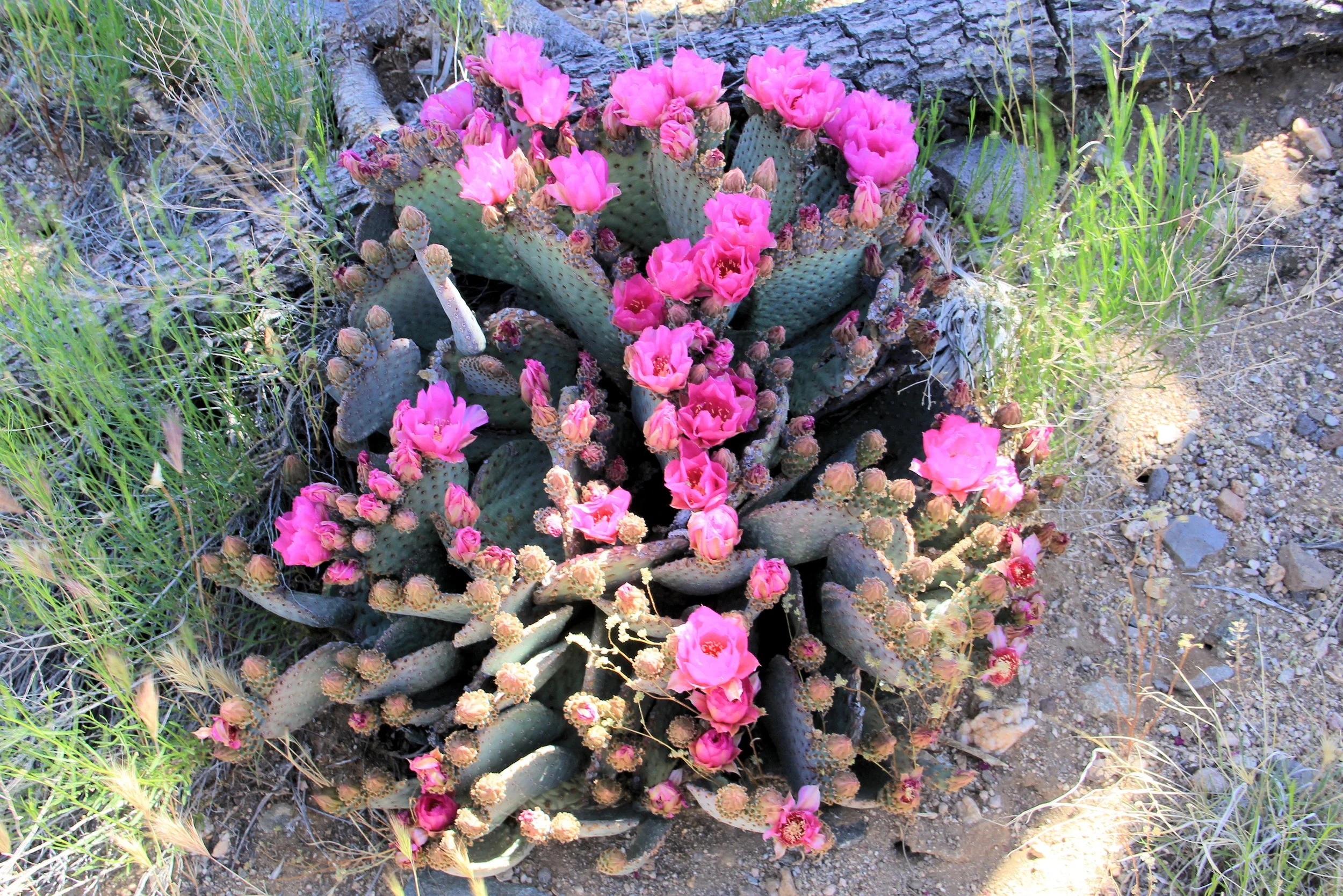
In addition to Joshua Trees, you will see Mojave and banana yuccas, buckhorn cholla, creosote bush, white bursage, bunch grass, matted cholla, prickly pear, and other species. This bio-diverse habitat makes for fascinating bird watching. The area through which the drive traverses has been designated by National Audubon and Bird Life International as an “Important Bird Area,” a national designation recognizing its importance for bird conservation. Birdwatchers may spot-Gilded Flicker (known to occur in Nevada only in this location), Northern Flicker, Ladder-backed Woodpecker, Black-throated Sparrow, Red-tailed Hawk, Crissal Thrasher, Verdins, Brewer’s Sparrows, American Kestrel. Golden Eagle, Common Raven, Loggerhead Shrike, Bewick’s Wren, Bushtits, Ash-throated Flycatchers, and Cactus Wren.
The Bendire’s Thrasher and LeConte’s Thrasher are also found in the Wee Thump area. Both of these trashers are species of concern for possible listing on the Endangered Species list because of declining populations. Avi Kwa Ame’s designation as a national monument helps ensures that their breeding habitats are protected for generations to come.
Other wildlife roaming the area include desert bighorn sheep, coyote, bobcat, mountain lion, desert cottontail, black-tailed jackrabbit, valley pocket gopher and desert wood rat. Occasionally, you may also spot the threatened desert tortoise. Bighorn sheep migrate through the Wee Thump Wilderness area from the South McCullough Range to the Highland Range.
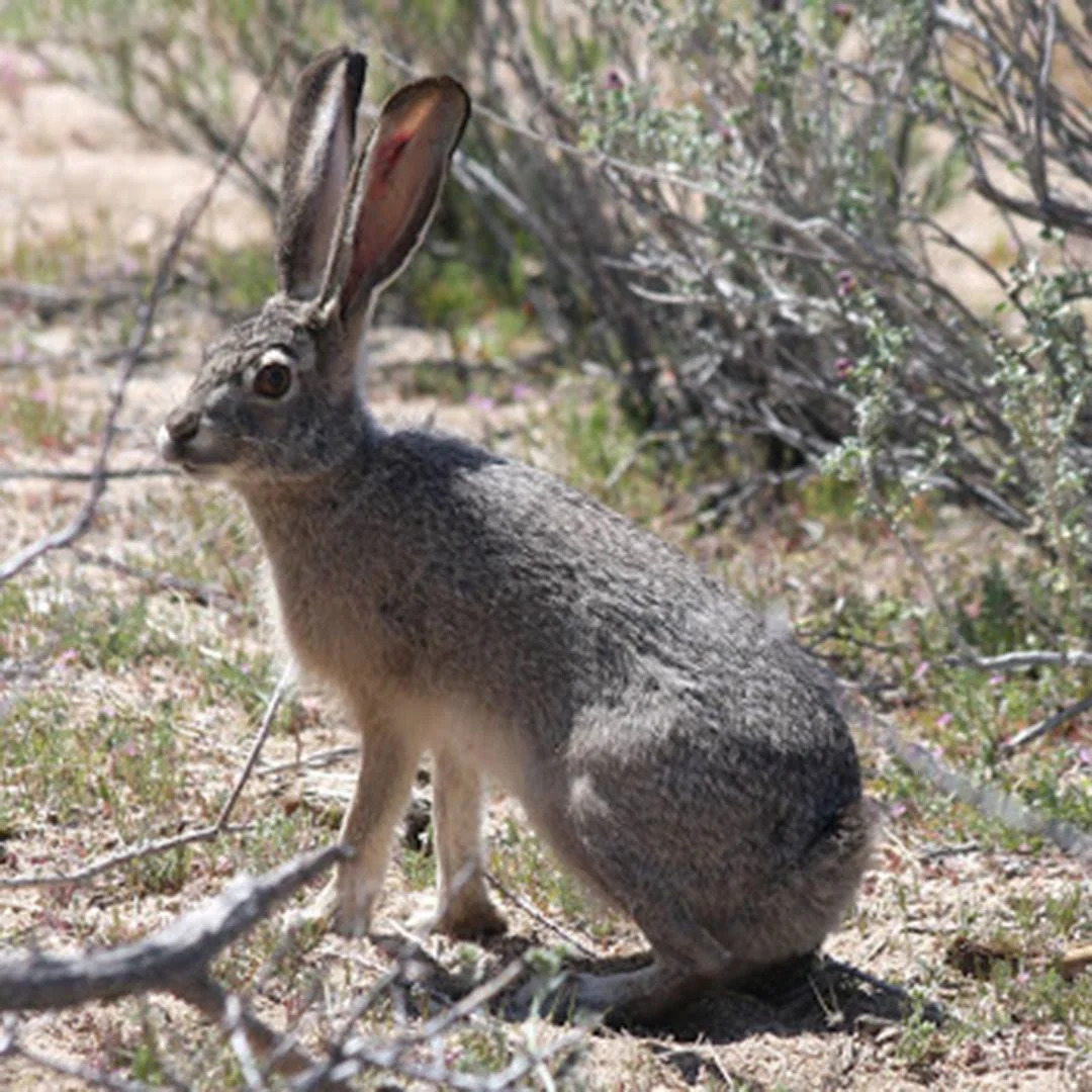
It is pretty common to see black-tailed jackrabbits along this stretch of the drive. Jackrabbits are larger and leaner than resident cottontail rabbits. A significant amount of blood flows through the many blood vessels of a jackrabbit's ears, which helps dissipate heat, an important adaptation in the desert. Reaching a length around 2 ft, and a weight from 3 to 6 pounds, the black-tailed jackrabbit is one of the largest North American hares. The black-tailed jackrabbit does not migrate or hibernate during winter and uses the same habitat of 0.4–1.2 square miles year-round. Its diet is composed of various shrubs, grasses, and forbs. The black-tailed jackrabbit is an important prey species for raptors and carnivorous mammals, such as eagles, hawks, owls, coyotes, foxes, and wild cats within the wilderness area.
At mile-mark 5.6, there is a transmission line maintenance road that heads southwest. Turn left on this maintenance road. The next 5 miles follows the northern boundary of the Wee Thump Joshua Tree Wilderness Area. Along this section, you have outstanding vistas, some extending some 70 miles. You can see the closer Eldorado and Newberry Mountain Ranges within the Monument but also the more distant Black Mountains and Hualapai Mountains in Arizona. Spirit Mountain (Avi Kwa Ame) can be seen looking Southeast. The habitat along this section is one of the most diverse and rich of any within the Avi Kwa Ame National Monument.
At the 9.7-mile mark, there is a junction of another backcountry road. Turn left on this road. You are leaving the transmission line maintenance road. Along this section, you get great views of Crescent Peak and the backside of the Castle Peaks to the south, as well as the New York Mountains located in Mojave National Preserve.
At the 10.5-mile mark, you reach Nevada Highway #164 and are back on a paved road. Turn left and it is a five-mile back to where you started the drive for a total drive of 15.5 miles.
Know Before You Go: Should you decide to travel this route, you do so at your own risk. Always take the appropriate precautions when planning and traveling, including checking the current local weather, trail/road conditions, and land/road closures. Carry the appropriate safety, recovery, and navigational equipment and obey all public and private land use restrictions and BLM Monument rules. Carry a full-size spare tire and tire patch/plug kit—and know how to use it before you need to. Be prepared for spotty cell phone service or even no service. Bring more water and food than you think you’ll need in case of any emergencies.
KNOW BEFORE YOU GO:
Should you decide to travel this route, you do so at your own risk. Always take the appropriate precautions when planning and traveling, including checking the current local weather, trail/road conditions, and land/road closures. Carry the appropriate safety, recovery, and navigational equipment and obey all public and private land use restrictions and BLM Monument rules. Carry a full-size spare tire and tire patch/plug kit—and know how to use it before you need to. Be prepared for spotty cell phone service or even no service. Bring more water and food than you think you’ll need in case of any emergencies.